Down to the horizon
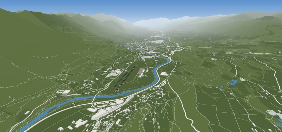
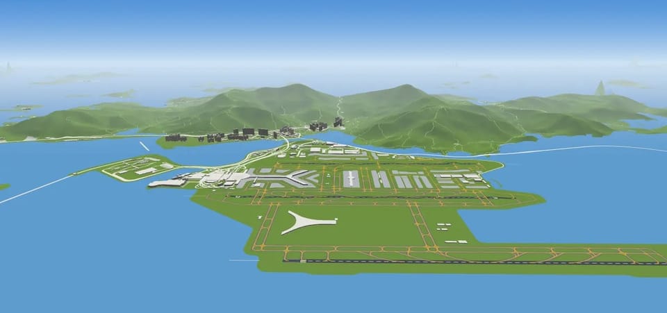
Innsbruck sits in the narrow Inn valley with peaks of over two thousand metres on both sides, and the approach follows the valley with its bends. Airlines send only crews trained specially for it. Hong Kong airport stands on an island that was levelled and extended with land reclaimed from the sea, and right behind the runways rise the mountains of Lantau. Show airports like these honestly and you can’t stop at the fence.
One beautiful 3D airport can be built by hand. Thousands cannot. So the scene is assembled from open data: runways, taxiways, stands and buildings from OpenStreetMap, terrain for the whole planet in two and a half million tiles. When a tile doesn’t line up with the map, the runway lights end up in the sea, so every one of them has to fit.
Hillsides are shaded by the sun of the scene, so the Alps above Innsbruck have a light side and a dark side at the very hour you’re watching. The ground fades into the haze of the sky towards the horizon instead of stopping at a hard edge. The aircraft never disappear in the haze.
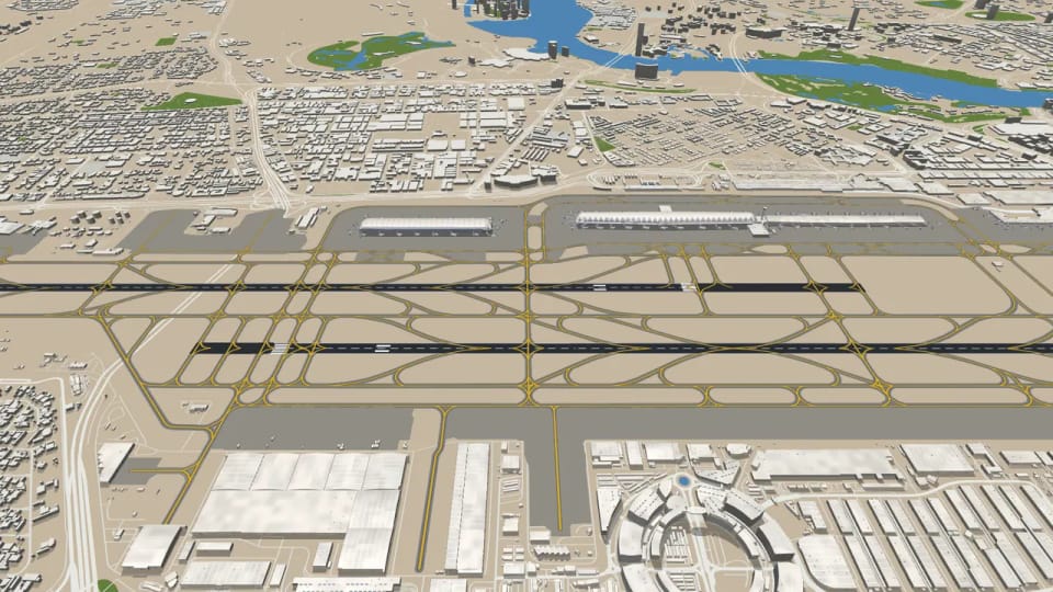
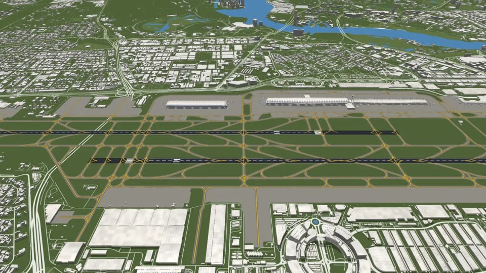
At the real airport in Dubai, no lawn grows around the runways. Between the taxiways there is sand and gravel, as in Doha, Riyadh or Phoenix, and anything green is green because someone waters it. For a long time, though, we drew the whole world like Prague: bright green grass round every runway. In Prague that was right. In the desert it looked like a golf course dropped into the middle of Arabia. It started with a simple question: shouldn’t Dubai have desert rather than grass? It should.
The map itself won’t tell you what colour the ground between the taxiways is. Grass areas are often drawn in it, but not their colour. So we gave every airport in the world, all forty-eight thousand of them, its landscape in advance, from two freely available scientific maps: the Köppen–Geiger climate zones and ESA WorldCover, a satellite map of what covers the ground. The first says whether the climate around the airport is dry, and whether it rains in winter or in summer. The second says how much bare ground there is nearby and what colour it is. From the satellite we take only those numbers, never the shape of anything. Where things lie is still drawn from OpenStreetMap, so nothing moves and nothing gets smudged.
2,007 airports came out as desert and 6,141 as steppe. Desert is not the same everywhere: the Gulf is beige, the Mojave around Las Vegas grey-brown, the Sonoran desert at Phoenix nearly brown. Steppe, at Denver, Salt Lake City or Madrid, is darker, with something growing in it. About 37,000 airports stayed exactly as they were, Prague, London and São Paulo among them.
We also thought about the seasons. Around the Mediterranean and in California the winter is green and the summer dry, so in Rome, Athens or San Francisco the grass dries to straw in summer and comes back in winter. Perth too, except that its summer falls in January. Johannesburg and Mexico City dry out the other way round, in winter, because their rain comes in summer. The scene goes by the date it is showing, so play back a January day and San Francisco is green. Around 2,750 airports change with the seasons like this.
A few details you might not expect. Watered grass, the parks and golf courses the map knows about, stays bright green even in the desert, because that is what it looks like there: green islands that somebody waters. The sand is deliberately a shade lighter than the concrete, or the taxiways would disappear into it. In photos Phoenix is darker than we draw it; here we put a readable airport first. At night the sand goes blue-grey like everything else, after rain it shines, and when snow falls on it, it turns white just like grass. Both maps are free to use with credit to their authors, and at airports whose ground they recoloured you’ll find them in the map’s list of sources.
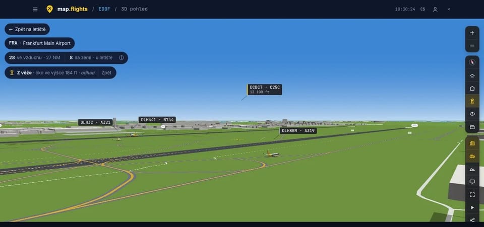
From the tower, with a camera in the window
A control tower stands where the cab can see every runway and taxiway, and at big airports the controllers still have ground radar for the corners the windows can’t reach. Tap ‘From the tower’ and our camera climbs into the cab, at the height where the controllers’ eyes are. Towers are recognised however the map happens to record them, and at night the cab is lit.
Live cameras are picked by hand, and our server checks each of them itself every twelve minutes. The button appears at an airport only if the stream was really on air within the last half hour, so it never leads to a dead video. Until you press play, nothing at all is loaded from the video service. Where we know where a camera stands and which way it looks, the 3D camera can take its place too, and we say plainly that the position is an estimate.
Internet video usually runs five to thirty seconds behind reality. The scene holds its aircraft back by the same delay, and you can fine-tune it second by second until the touchdown in the stream and on the map happen together. The camera window stays open while you move between the map and 3D.
A bridge to the front door
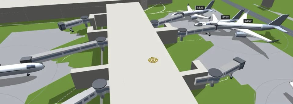
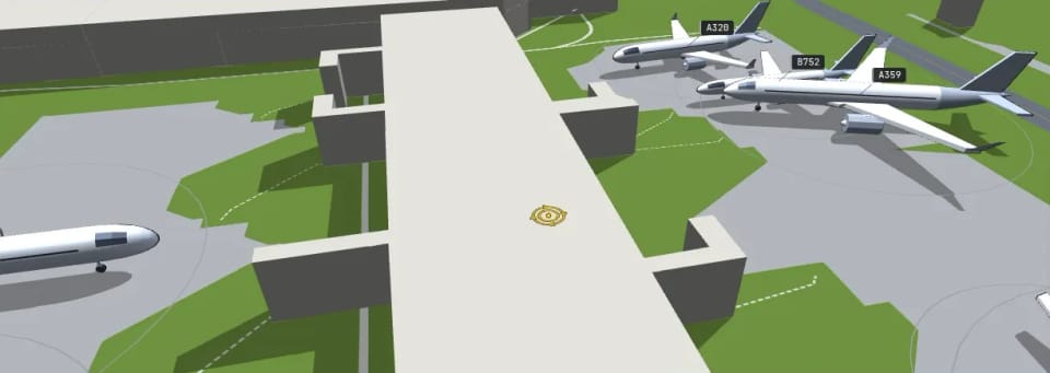
At a real airport the jet bridge may only move towards the aircraft once the red beacon on the fuselage goes off, the sign that the engines have stopped. Then it docks at the front left door, the one passengers actually use. Ours moves out once the aircraft has stood on the stand for a minute, and it stops at that same front left door. It never passes through the aircraft or a neighbouring bridge: when there is no room, the tunnel shortens, turns aside, or isn’t drawn at all. An ATR doesn’t get a bridge, because its main door is at the back, and neither do small aircraft, helicopters or business jets.
JFK and Atlanta each have more than 150 bridges in the map data. Prague has not a single one, and neither do Frankfurt, Madrid, Barcelona or Rome. So at a terminal with no mapped bridges we derive them from the stands whose aircraft park nose-in to the building. We tested that blind at twenty airports where the bridges are mapped: 88 percent of the derived bridges stood at a stand that really has one.
At night the bridges take on the colours of the buildings around them, and their glass glows like the terminal’s windows.
Corridors in the air
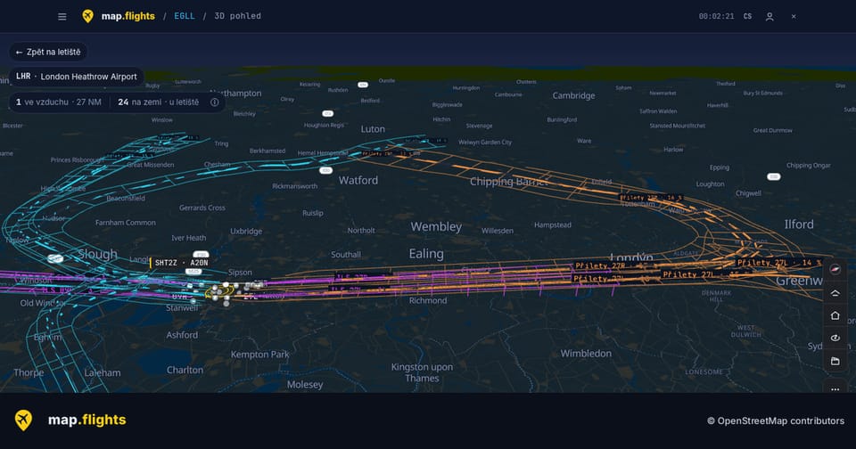
ILS guides an aircraft to the runway with two invisible beams: the localizer keeps it on line, and the glide slope transmitter, standing beside the runway a little way in from its start, keeps it on a slope of usually three degrees. In good weather crews fly the same lines anyway, so arrivals bunch into narrow corridors.
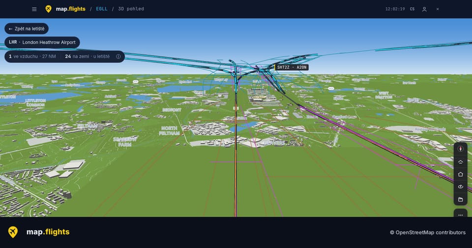
Over Heathrow, the positions our own network heard in the last 24 hours add up to the corridors aircraft really fly: the long arrival curves over London, the departures fanning out west. Every point of a corridor has to be carried by at least three different aircraft, so no single flight can be read out of it.
A glide path is drawn only where the ILS antenna really stands on the map, at the standard three degrees. Prague and Heathrow have it. At JFK the map knows only the localizers, so you see just the course on the ground, labelled as such, and at Tokyo Haneda the map has neither yet.
The jet bridge stops at the front left door, the one passengers really use, and an ATR doesn’t get one because its door is at the back.